Places of passage: Penhas Douradas, Manteigas, Skiparque / Relva da Reboleira, Vale de Amoreira, Valhelhas.
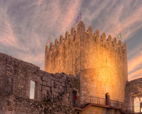
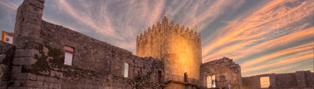
From the Rossim valley, the route rises towards Penhas Douradas and descends along the mountain chalets to the Weather Observatory. It continues along a dirt road that crosses the EN 232. It then leaves the tarmac again, to continue along a steeper and winding technical descent, that is partially on a stone road. After crossing Manteigas and the bridge over Zêzere, the route follows the GR33 to near Vale Formoso. Following the right bank of the river, it continues downstream, first with good views of Manteigas, on the opposite slope. It crosses an impressive chestnut grove, the Souto do Concelho. However, in the Sameiro area, the pine forest and heather bush begin to prevail. At the bottom of the valley, plots of farmland and small pastures can be seen. After an excellent view on the village of Sameiro, the route passes by the Skiparque infrastructure and the Relva da Reboleira river beach. In the final part, it crosses the Zêzere river to the left bank, and soon enters Vale de Amoreira. It leaves Vale de Amoreira heading east, in a path parallel to the EN232, next to farm fields and the Zêzere river. It crosses the road and starts to go up the slope between the pines, and then it descends until it meets the tarmac again. It passes through the centre of Valhelhas and crosses the river in the river beach area until near Vale Formoso, where it separates from the GR33, following the GR22.1 variant towards the Historical Village of Belmonte. It passes the river and heads north, towards the castle.
Fauna and Flora
_VALE DO ROSSIM_ In the waters of the reservoir otters can sometimes be seen, hunting the fish they feed on. These high-altitude waters do not attract a lot of waterbirds, but, in the fall, the surrounding area becomes very interesting to watch migratory birds, such as the song thrush, looking for the ripe fruit of the rowan. In the margins of the reservoir some plants with botanical interest grow, such as the Linaria elegans, an Iberian endemism. Another Iberian endemism, the Guadarrama wall lizard (Podarcis guadarramae), enjoys the sun-bathed granite blocks. The shores of the lagoon are flanked by willows and the adjacent woods are made up mostly of birch and Scots pine (Pinus sylvestris). The ridge that dominates the left bank of the reservoir culminates in a rocky area made up of big entrenched cliffs, the Penhas Douradas, which give the area its name. _MANTEIGAS_ Manteigas presents one of the best forest surroundings of the mountain range, made up mainly of chestnut and oak trees (Souto do Concelho), but also by many other native tree species and species introduced by the old forest services during the late 19th century. From the second half of the twentieth century, the afforestation, especially with maritime pine, intensified. This forest canopy gives shelter to countless forest birds and mammals, such as the European roe deer (Capreolus capreolus), the wild boar (Sus scrofa), and the red squirrel (Sciurus vulgaris). It is crossed by the Zêzere river, where the largest glacier in Portugal ended, about 25 000 years ago. Starting at the highest points of the mountain range, it extended for 13 kilometers. This glacial morphology is also associated with the Vilariça Fault, one of the most important tectonic accidents in Portugal. _VALE DE AMOREIRA_ Like most of the territory, the large percentage of the surrounding forest cover is made of pine forest. The riparian gallery that follows the banks of the Zêzere is made up of alder trees and willows, and on the right bank of the river, beyond the pine forest, evergreen oaks of small size appear. The Zêzere describes here a steep curve, forming a wide floodplain used for grazing. It is also in this meadow that the common buzzard (Buteo buteo) looks for its prey. The river is visited by the grey heron (Ardea cinerea) and the common kingfisher (Alcedo athis), as both feed on fish, as does the elusive common otter (Lutra lutra). The grey wagtails (Motacilla cinerea) roam the banks looking for insects, amongst polished rolled granite and schist pebbles. _BELMONTE_ Serra da Esperança, where the HV of Belmonte is located, is a hill mostly covered by shrub species but where some pine areas can still be found and where the fortified settlement of Castro da Chandeirinha was established, proving the ancient occupation of this area. The river Zêzere, with its source at a height of about 1900m, flows restlessly down Serra da Estrela, to become more serene as it passes through Belmonte, setting the tone for the ecology of the place. The different uses Man made of this river can be seen throughout its course and are particularly linked to the production of fruit trees, especially the famous peach of Cova da Beira. We are welcomed into Serra da Estrela by a wonderful mosaic of woods, composed of chestnut trees, birch trees, and even the imported Pseudotsuga (Douglas firs) trees, with a foliage that if full of different tones in the fall.